Monitoring
To ensure our seagrass conservation work is impactful, each of our Blue Meadows sites are monitored over a minimum of 3 years.
A key element to our seagrass protection and restoration efforts is monitoring the meadows to make sure our work is impactful.
In general, mapping and monitoring of sensitive habitats in the marine environment is challenging. We overcome this by using a variety of different methods to monitor the seagrass meadows we are protecting and restoring.

Diving
Our professional dive team are key players in the monitoring of our current Blue Meadows protection and restoration sites, and assessing the potential of new sites. There is great value in getting ‘eyes on the ground’ to assess the seabed, and as subtidal seagrass can be found up to 10m below the sea surface, divers are needed to collect the information.
Our divers assess the extent and condition of the seagrass beds at our Blue Meadows sites. To assess the condition of the seagrass meadows, they take a number of measurements including, the number of shoots within a quadrat, measuring 3 random leaf lengths and also measuring the longest leaf. These measurements are chosen because they are all health indicators for assessing growth of the seagrass over time.

Drop Camera
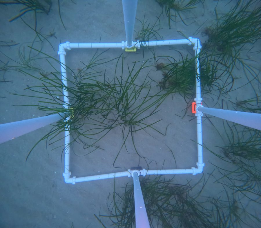
Whilst collecting data to support our own seagrass conservation work, we also collect data that aligns with and feeds into larger data sets. The drop camera methodology aligns with ground truthing methods used by the Environment Agency, so we built an apparatus to help us do this, which we lovingly named ‘Quadpod.’
We lower the Quadpod onto the seabed using a davit which swings the apparatus off the side of the boat, giving it a clear line of sight down to the seafloor. The Quadpod is lowered and takes a photo of the seafloor using the Go Pro which is positioned above the quadrat.
For this method to be possible without the assistance of divers, we attach a long cable to the underwater GoPro, linking it to a tablet on the boat. This allows us to see what the camera sees underwater and take a photo. We then collect information on the depth, location, substrate and seagrass coverage within the quadrat. This is repeated at points equally spaced across an entire site allowing us to get a broad understanding of where the seagrass is, its condition and any possible areas that could be suitable for restoration.

ROV
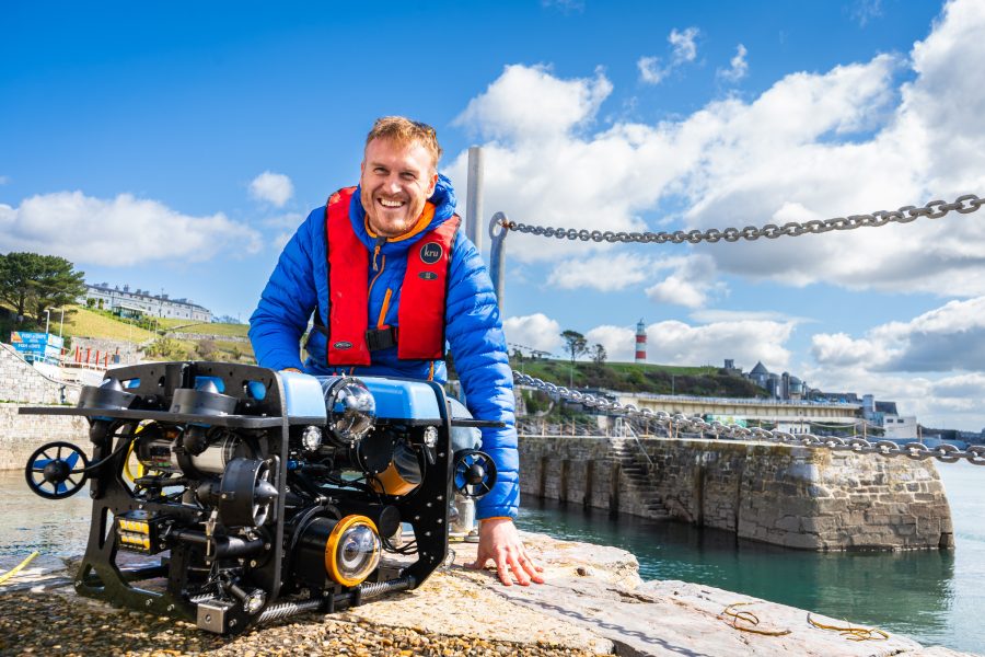
Working in partnership with Sonardyne, MarineSee, Voyis and Blue Robotics, we have developed a specialised Remote Operated vehicle (ROV); an exciting tool that will enable us to map seagrass in unprecedented detail!
Using state-of-the-art underwater positioning technology, the ROV is capable of producing high-resolution photogrammetry to track our restoration efforts and monitor established seagrass beds. Complemented by other exciting acoustic technologies, we are aiming to demonstrate a more comprehensive way of mapping and monitoring seagrass, to support our protection and restoration activities. The ease and precision of repeatability will also enable us to much better understand seasonal and annual change in the seagrass meadows, so we can expand our knowledge around each of our restoration sites.
eDNA Sampling
eDNA is a method of detecting species within a location through water and sediment samples. Species are detected through DNA which is found within the water. We collect water samples across our Blue Meadows sites which are then analysed by Nature Metrics. The results show us which species have been detected within the area and the strength of the marker signal, allowing us to assess biodiversity at a site.
Carbon coring
We take sediment cores across out Blue Meadows sites to analyse the carbon content and see how much carbon has been sequestered within the sediment over time.


